Question
Can I perform takeoff on a Google Earth™ image?
Answer
Yes!
Google Earth images can be used within On-Screen Takeoff for excavating, landscaping/site planning, and many other pre-construction methods.
For in depth information on using Google Earth, please contact Google's technical support directly.
To use Google Earth images with On-Screen Takeoff, perform the following steps:
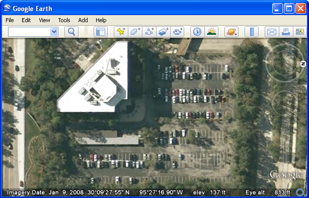
In Google Earth, start by zooming into the area you wish to perform takeoff on (the larger the image the better, so zoom in as tight as possible)
Click View > Scale Legend to turn on the scale
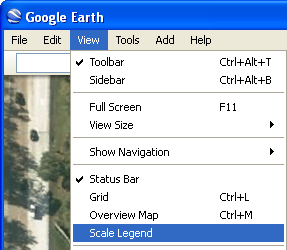
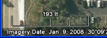
The scale will show in the lower left hand corner of the image
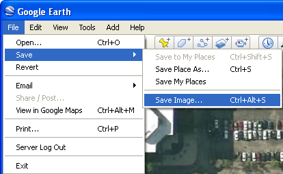
Click File > Save > Save Image... to save the image in JPG format to a specific location on your computer or network
In On-Screen Takeoff create a new Bid or open the Cover Sheet to an existing bid and add the image
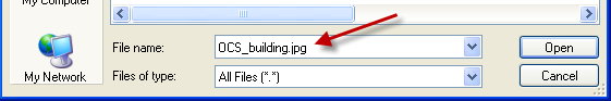
In the Add Images window, select All Files (*.*) from the Files of type drop down menu in order to select JPG images
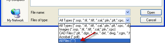
The JPG image will show in the File name section, click Open to finishing adding it to the Bid or Cover Sheet
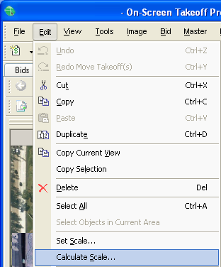
Zoom in to the area where the scale is listed, and then click Edit > Calculate Scale...
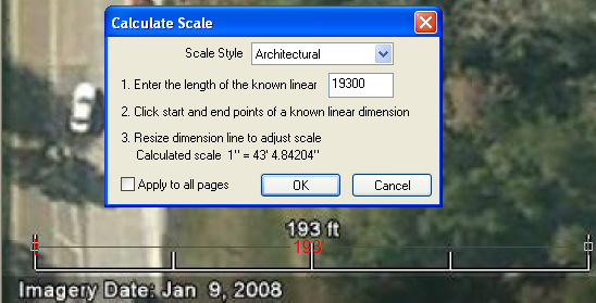
Enter the length of the known linear, click the start and end points of the scale, and then click OK - Remember, the scale will be in feet and inches so for 193', you will enter 19300 (193 feet 00 inches)
Once the scale is set, you are ready to perform takeoff

